Showing posts with label GPS. Show all posts

Monday, August 13, 2012

Official Geocaching App iPhone Review

The Geocaching App for the iPhone is one of the easiest ways to go Geocaching now. It's added hundreds and hundreds of people to the game. But is it worth the price?

1. Accuracy

Since January I have found over 700 caches using the Geocaching App and have rarely had issues with accuracy. In fact it probably is more accurate than your standard GPSr when considering how long it can take a GPSr to get a signal.

2. Mobility

The Geocaching App benefits from being on the iPhone because it has a data plan which allows you to download caches on the fly. This has worked for me several times  (including just last week) when I stumbled upon a cool spot while driving or I'm stopped with friends or family during a roadtrip and want to see if there is a cache nearby.

Having a Premium account is even better since you get the Pocket Query functionality. This lets you save your data (and money) and save the caches and required maps to your phone, with this I was able to cache in both the Bahamas and US with ease. No looking up a ton of maps to add to your GPSr.

3. Maps

The maps for the Geocaching App are great. You have the choice between the Terra maps, Street Maps and Google Satellite maps. A downside is that you cannot download the Google maps to your iPhone.

 4. Logging

A great feature of the App is logging your caches. As long as you are a fast iPhone typer, submitting logs while out in the field is simple and you can even submit photos!

5. Trackables

One of my favourite features is the trackables, simply type in the tracking number and you get the goal, recent logs and the ability to discover or pick up a trackable. Really useful in the field.


Overall the Official Geocaching iPhone App is a great buy, especially when tied to a premium membership. Well worth the $10 A great buy.

Saturday, March 26, 2011

A Proud Papa

It took awhile but I finally got the Geocache "Placing" bug. I recently placed two new caches, making my total placed caches four. This, combined with the emergence of spring, has spurred a flurry of activity in my area. Both have been found around 15 times. Pretty good considering the crappy weather we've had recently.

But I've figured out what makes placing caches so fun for me. The logs! My first solo cache was floating around in my head for awhile and I finally took the plunge. I got my cache (micro) ready and got my GPS and I was off. I spent only maybe a half hour or so looking for the best possible spot which unfortunately was hard to come by since all the major branches in the area were cut down and the hook for my cache to hang with was too small. At last I spotted a place (at the time I thought I was settling, now I realize it was perfect) and got my coordinates (I also double checked them).

After submitting it and having it go live I waited to see the response it would get. So far it's been really positive! Most saying they enjoyed the cache or that the coordinates were dead on. And that means a lot coming from cachers who have almost 4000 finds! Both my new caches have people who submitted pictures and someone also used my cache for their 100th cache milestone!

It's a strange feeling of pride. Like the caches are my children and I'm the proud father or something. Placing your own caches is a rewarding experience for sure. And to me it emphasizes that if your going to be placing caches, do it right!

(Also, try to be nice in your logs ;) )

Saturday, March 5, 2011

Guide to Posting Geocaches

  1. Scout the location
    1.  Use GIS maps (many counties have them) or whatever you can find to figure out who owns the property
      1. If private then make the request to the owner, have information like this Official Guide (pdf)
      2. If public (like a park) then make an attempt to find out if they have a policy on geocache and try to find a way to contact the park manager.
    2.  Go to the location yourself. 
      1. Identify things that may be hazardous to cachers this could include roads, railways, a lamp post with wires sticking out, a minefield, who knows? 
      2. Identify problems the cache itself may cause. This could be harm to the environment, muggle threats or issues the police may have with it.
      3. If its a park, find out if there are certain open hours.
      4. Consider the terrain rating. One spot may be better if it's accessible to those with disabilities or children. 
  2. Make the hide
    1. The right container
      1. Your first concern is making sure you have the right container. A general rule of thumb is the farther the walk, the bigger the container. 
      2. Make sure you container doesn't look dangerous. This means "pipebomb" containers are right out.
      3. If it is a size small, regular or large, be sure to have some "swag" in the container
      4. It's optional but many have a prize for the FTF (may be a gift card or geocoin)
    2. The Spot
      1. Make sure the hide isn't obvious, not only to keep muggles from finding it, but to give cachers some challenge
    3. Get the coordinates
      1. DO NOT USE GOOGLE MAPS OR ANY OTHER ONLINE MAP SYSTEM
      2. Use your GPS to find the coordinates for a cache. Walk towards the cache from different directions and note whether or not the coordinates are right.
      3. Note any issues with your GPS (the signal lose strength in the area?)
      4. Also grab the coordinates of any parking lots or trail entrances in the are
  3. Posting the hide
    1. Cache Type: This is pretty simple...
          • Traditional cache is where you simply have coordinates to find the cache
          • Multi-Cache is a cache where there are multiple stages to find a cache.
          • Puzzle Caches are caches which require you to figure out the coordinates from a puzzle.
          • Events, Letterboxes, Wherigos and Earthcaches have their own guides later
      1. Terrain/Difficulty use the information you got while scouting the area with the system provided
      2. Short description this is a brief description of the cache, include its location, description of the container and any other must know information (how to get to the cache for example). If you don't have coordinates for a parking lot, recommend the nearest legal street parking here too.
      3. Long description this can be as long as you want, you can put an interesting story or the history of the area here. What you put in the cache would also be perfect here.
      4. Hints There are a couple factors that come into play here:
        1. How easy is your cache?
        2. Is the GPS signal strong in the cache area? If your cache is at the bottom of a canyon with a weak signal and is well hidden, for the love of god you better tell me exactly where that cache is in the hint
      5. Note to Reviewer The saying goes "an ounce of prevention is worth a pound of cure" in other words save yourself some hassle and explain your cache to the reviewer. Example: "My cache is a standard micro in a park" or "This cache is behind a business I have the owners permission"
      6. Above all else make it look professional. It should be easy to read, contain no spelling mistakes and have proper grammar.  My first thought when looking at your cache should not be "Did a three year old write this?"
      7. Submit the cache
    • Activation
      1. We're almost there! View your cache listing
        1. Add your waypoints this includes your parking information or trail head information
        2. Attributes. Totally under utilized feature. You have 10 attributes that you can place on your cache.
          1. First mark any Equipment needed to get the cache (boats, climbing gear, etc.) and Hazards such as cliffs, animals or thorns!
          2. Second mark any Conditions, especially availability at night, hike distance, winter availability and whether its appropriate for children.
          3. 3rd is Permissions this is important for people with dogs or bikers
          4. Finally add Facilities. This can be important for people who are planning trips and may want to make a stop in your area.
        3. Give it a once over, are the coordinates right? Is spelling right? Is all the information there?
    • Enable the listing! You're done! Just make sure you read the logs and maintain the cache!

    Monday, January 31, 2011

    Geocache Challenges

    Challenges are one of the most interesting 'unofficial' aspects of geocaching. Basically Geocache Challenges are a simple traditional cache with coordinates, anyone can go and find the cache. Logging it is the tricky part. There are various rules that a CO (cache owner) can create for geocachers to be able to log the cache.

    For example, I've already said that I am taking part in the Ontario Holiday Challenge. But there is a literally limitless amount of challenges! Endurance challenges encourage you to find a cache once a day for a month or even a year! Chart challenges make you fill out your Difficulty/Terrain Chart (or your Year Chart or month (finding a cache for each day of the year or month (sometimes including leap years! 2012 here I come...).

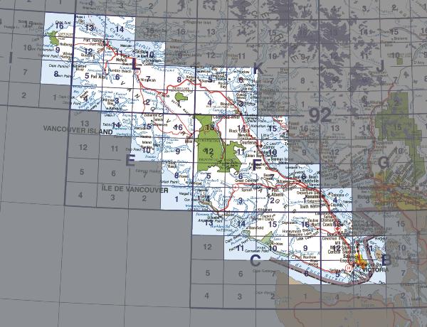
    A Vancouver Island challenge where you have to find a cache in every box


    Keep in mind that these can all be in specific locations too. There's DeLorme challenges where you must find a cache in every section of a map. Challenges where you have to find a cache in every county of a state. Caches where you have to find caches with names that start with each letter of the alphabet. 

    Geocache Challenges are pretty much unlimited. You could have ones where you have to find a cache on every mountain in an area, or the 10 highest mountains in North America, one on every river, who knows? They're a fun and interesting part of geocaching and it's only a matter of time before they're made a bigger part of the game.

    Saturday, January 1, 2011

    2010 In Review

    January & February- I was... a....... muggle!
    March- Got my first cache (and first DNF) on the 19th. Sharon12's first cache was on the 26th. First Multi on the 30th.
    April- First Puzzle and Series cache on the 1st. My first US cache and Earthcache on the 13th. On the 27th I went on my first power trail and got my 100th cache.
    May- Started off with a bang getting 15 caches in Petrolia, Ontario.I got my first Virtual and I had my first event too.

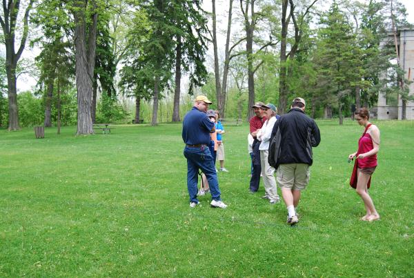
    At Introduction to Geocaching, my first event cache


    June- I reached my 200th cache. I got my first FTF and did one of my favourite caches of the year.  I also introduced my friend Rob to geocaching.
    July- An excellent month with dozens of fun caches, including more caches in New York and the amazing Devil's Punch Bowl Earthcache. The things right in our backyard that we don't even see.
    August- I attended my first major event- Dairy Daze V and the last Harvestfest and got my first Letterbox cache.

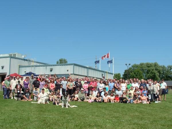
    Our first and last Harvestfest


    September- Got 50 caches while on a trip including caches in Arizona, California and Nevada where I got my first Webcam Cache. I also placed my first cache!
    October- I attended the Petrolia Discovery Event where I got my 500th cache. I set personal records for most finds in a day (38) and most in a month (95). No doubt getting my Magellan Triton 500 this month helped.
    November- I started the Geocache Tribune and got my first puzzle FTF.
    December- I hate the cold, I only got 12 caches for Dec. But one of them was my 600th cache and an FTF making it 7 months of FTFs

    Looking at 2011: 2011 is going to be a good year. I plan on attending Geowoodstock and getting some challenging caches. My goal for the year is 2500 caches.  That would be 4 times more than this year. I have a bunch of ideas for caches and I can't wait.

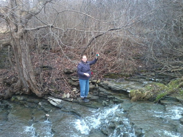
    Sharon12 holding up a cache


    Have a good 2011 everyone!

    Wednesday, December 15, 2010

    Geocaching.com Updates INCOMING!

    Recently announced by several sources are a number of large updates coming to geocaching.com (GC). The first is stats, which have been done outside of GC by GSAK, mycachingprofile.com and CacheStats. GC acquired mycachingprofile.com and will now be fully featured on profiles.

    Also big news is the new Favourite system. This will likely be a Members only feature where depending on the number of caches you have, you get a certain number of Favourite Points. These points can be given to caches of your choice (not your own hopefully). I think this idea is far better than most DIY geocache rating systems on the internet.

    Finally and biggest of all is this...


    Yes on screen that is every geocache in EUROPE! Also notice the differences in icons, it make you wonder what other goodies they have tucked in there.

    Theses updates are supposedly going to be implemented before Christmas! More details will be coming soon I'm sure.

    Friday, December 10, 2010

    OpenCaching.com... Competition or Plan B?

    There's been a lot of buzz surrounding OpenCaching.com, and rightly so. GPSr manufacturing juggernaut Garmin opening it's own geocaching website is huge. Garmin directly competing against GeoCaching.com seems almost like an attack on a site that has practically built geocaching (and sold a lot of Garmin products in the process).

    And that's not going to go without controversy. Delorme and Magellan have both backed Geocaching.com Of course no one expected otherwise. But the question that needs to be answered: Why is Garmin doing this at all?

    Market share is a part of it. But the real issue: Stability. Let's face it, car navigation systems are on the way out. Cell phones are quickly adapting to GPS and people don't want to buy a GPSr if they don't need it. So who is going to buy Garmin GPSrs? Geocachers, that's who.

    Geocaching is unique in that there's really only one source, that being geocaching.com. Garmin knows that relying solely on geocaching.com is dangerous. Terracaching.com is closing and that took a lot of people by surprise. Anything could happen, Groundspeak could be breaking some tax law you and I have never heard of and be shut down. It could be hacked or have a DOS attack, who knows? This is the Internet and things happen. So what would Garmin do then? What would YOU do then?

    If this were really about promoting Garmin products, why are other GPSrs allowed? In fact I don't see any mention of Garmin GPSr products on the site, even the "GPS Devices". People can go on all day about competition and how it advances things. But really the win here is that not only Garmin, but the Geocaching community as a whole has a back-up to geocaching.com. Opencaching.com might just keep our community alive and, at least for now, sleep a little better at night.

    Wednesday, December 1, 2010

    GPSr Review: Magellan Triton 500

    The Triton 500 is a fine piece of hardware. It's very accurate and easy to use. It has tons of features for geocaching, trails, and way points. In fact the only big problem with the 500 is its supporting software, Vantagepoint.

    When I first installed Vantagepoint several days before I got my 500, I was excited. It looked similar to Google Earth and felt like iTunes. Then I started adding in the geocaches and it worked beautifully! Using the file system I quickly had them sorted out into cities and then regions within cities and then specific trails and dense areas.

    "THIS IS GREAT!" I thought, just being able to select a file and throw it on your GPSr and have all the geocaches in town? Brilliant. And with them saved on your computer you'd be able to add them to your GPSr offline! So where could we go wrong?

    Then the Triton came in. I went in to upload the caches in my area and was greeted with a list of the 500 caches I had in Vantagepoint. What? You can't just select a folder to add? WHY BOTHER WITH THE FOLDERS AT ALL THEN!? WHAT A TEASE!

    Now let's get to the other problems. The base map that the Triton comes with should be something standard right? Wrong. The base map for the Triton 500 is HORRIBLE! You'd think it would be something akin to a Google map, with roads and such. But no, it only shows highways and those are mostly off too. I get that Magellan wants to make money by selling maps, but holy crap, its $200+ GPSr with a blank screen. And your asking me to shell out $100+ just so I can use it?

    Luckily you have the option to find maps online and it's lucky that there's a decent community behind the Triton. So I added a whole bunch of Ontario maps which work out pretty well. Unfortunately to do this you have to go through VantagePoint, which brings us to our next problem: Freezing. Vantagepoint freezes, a lot. Trying to add maps? Freeze. Trying to add geocaches? Freeze. Then there's blue screens. Yes plugging in the Triton 500 to my computer cause Blue Screens of Death too. If someone knows how to fix this please let me know. But really? It's inexcusable. The Triton also has issues where it shuts down too.

    Now if this is sounding like a rant I apologize. Its not. I actually love my "Maggie", 99% of the time it's been right on target. The breadcrumbs system gives you a reference from which you can orientate yourself. The compass tools, Geocache descriptions and hints work well too. And although I've been told batteries don't hold up well, in my field use, the batteries have stood for me a good 20 hours. Which is usually two good long geocaching days at least.

    In conclusion, the Triton 500 is a great GPSr hobbled by its supporting software. Think of VantagePoint as the Annie Wilkes and Paul Sheldon as the Triton. Am I going to throw this GPSr away or sell it? No, I like it too much. But the problems with VantagePoint will definitely make me look at a cell phone GPSr or Garmin next time.